Photos | Navigating San Diego
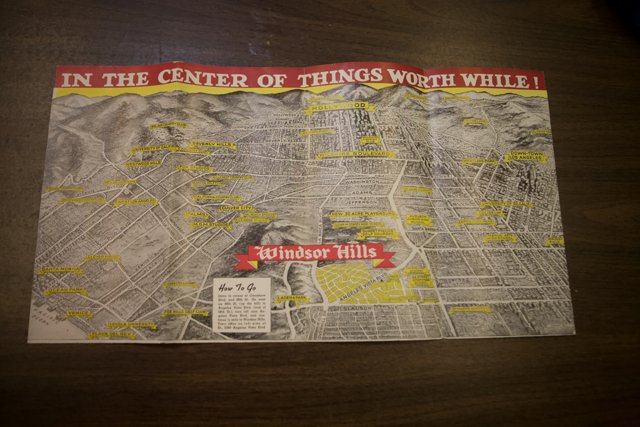
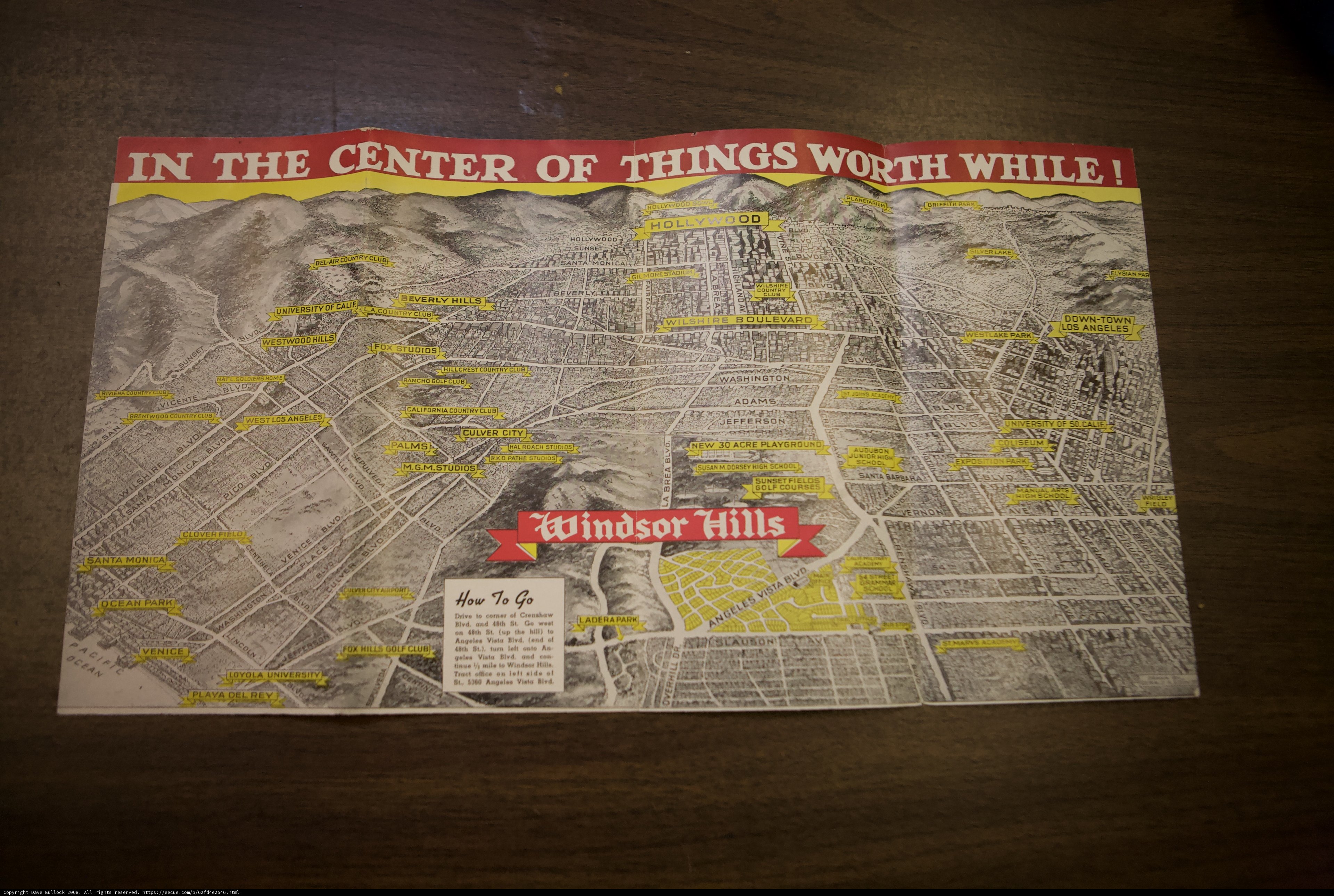
A detailed map of San Diego rests on a table, waiting to guide residents and tourists alike around the city. This 2008 document serves as a helpful tool for anyone looking to explore everything the vibrant city has to offer.
BLIP-2 Description:
a map of the city of san diego is displayed on a tableChronologically Adjacent
Note: You can also navigate with your arrow keys or swiping.
Metadata
Capture date:
Original Dimensions:
4368w x 2912h - (download 4k)
Usage
Dominant Color:
advertisement plot santa calif coun studi new playa worth vista poster air bel newspaper playground things sf_archives publication business westwood magazine rey city monica document acre palms windsor roach university card beverly bivo hal del los center go comer crenshaw sf drive text angeles paper map club hills chart country holi venice archives culver west california
Detected Text
iso
1600
metering mode
5
aperture
f/2.8
focal length
28mm
shutter speed
1/640s
camera make
Canon
camera model
lens model
overall
(29.54%)
curation
(25.00%)
highlight visibility
(1.98%)
behavioral
(10.02%)
failure
(-0.76%)
harmonious color
(0.29%)
immersiveness
(0.68%)
interaction
(1.00%)
interesting subject
(-66.99%)
intrusive object presence
(-3.37%)
lively color
(-9.63%)
low light
(29.44%)
noise
(-8.06%)
pleasant camera tilt
(-5.24%)
pleasant composition
(25.85%)
pleasant lighting
(-10.93%)
pleasant pattern
(4.32%)
pleasant perspective
(22.02%)
pleasant post processing
(-1.06%)
pleasant reflection
(-2.33%)
pleasant symmetry
(3.32%)
sharply focused subject
(5.30%)
tastefully blurred
(2.09%)
well chosen subject
(26.12%)
well framed subject
(53.22%)
well timed shot
(-2.16%)
all
(5.92%)
* WARNING: The title and caption of this image were generated by an AI LLM (gpt-3.5-turbo-0301
from
OpenAI)
based on a
BLIP-2 image-to-text labeling, tags,
location,
people
and album metadata from the image and are
potentially inaccurate, often hilariously so. If you'd like me to adjust anything,
just reach out.